Imagine Learning
Power up your Back to School ‘24 with resources and tools
Traverse Explorer

Federalism in the U.S. Highway System 

Explore the United States through a map of the U.S. Interstate Highway system and discover how federalism enabled its creation. 

Engage

Learn about Federalism through the Traverse 360 video. 

Analyze

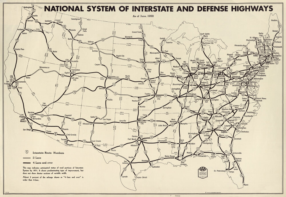
National System of Interstate and Defense 

Genre: Map | Creator: American Automobile Association | Date: 1958 

Background 

In 1956, President Dwight D. Eisenhower signed the National Interstate and Defense Highways Act. The bill called for the largest public works project in United States history: an interstate highway system. The highways would span 41,000 miles and cost $25 billion. This map shows how that system would crisscross the United States. 

Click to see the full map

Collaborate

Give One, Get One 

Pose the following question to students:  

Based on what you can gather from this map, what was the advantage of an expanded interstate highway system? 

Have students write several answers to the question. 

Have students move around the room and talk with other students to give and get ideas in response to the question. Students should try to get at least one new idea from each peer conversation.  

Call on several students to share an idea they got that shaped their thinking. 

Teacher Resources

Think Like a Historian

Use this additional sourcing information to further contextualize the source in order to deepen students’ analysis and evaluation. 

Summary

This 1958 map, published by the American Automobile Association (AAA), shows how the interstate highway system will eventually span the United States. 

Purpose

The map’s purpose is to give viewers an understanding of how the U.S. highway system will crisscross the country upon the completion of this public works project prompted by the Federal-Aid Highway Act. 

Intended Audience

This source was probably made available to the members of the AAA but was also helpful for U.S. drivers and the public at large. 

Source Considerations

The interstate highway system was first conceived in 1939, but because of debate over its funding, it didn’t receive full government support until 1956. Eisenhower knew the highways could be used to evacuate citizens in case of nuclear war. 

Scaffolding and Differentiation

Use the following information to provide reading comprehension support. 

Media

Encourage students to take advantage of the map’s key to draw conclusions about the impact the then-new interstate highway system might have on citizens and cities across the United States. 

Genre 

Maps are an important visual tool people use to understand the world around them. Remind students that printed road maps like this one were vital in helping motorists navigate from place to place before the advent of GPS technology. 

Already a customer? See the full experience in Traverse!

Search the Library for additional lessons and resources.

Log in to Traverse

Interested in learning more about Traverse?

Inquiry driven. Media powered. A new approach to social studies.

Learn More

Engage, analyze, and collaborate with Traverse Explorer.

Read More